Skip to content
Destinations
Weather & climate
Nature
Outdoors
Culture
Events
Sky & live
Ruffinischlösschen
Photo: Gliwi · CC BY-SA 3.0 · Wikimedia Commons
RuffinischlösschenReport this photo · linked, not stored
Alt St. Margareta
Photo: Gliwi · CC BY-SA 3.0 · Wikimedia Commons
Alt St. MargaretaReport this photo · linked, not stored
Alt St. Margareta
Annabergweg 11
Photo: Gliwi · CC BY-SA 3.0 · Wikimedia Commons
Annabergweg 11Report this photo · linked, not stored
Annabergweg 11
Theklakapelle (Landshut)
Photo: Rufus46 · CC BY-SA 3.0 · Wikimedia Commons
Theklakapelle (Landshut)Report this photo · linked, not stored
Theklakapelle (Landshut)
Burghauser Tor
Photo: Rufus46 · CC BY-SA 3.0 · Wikimedia Commons
Burghauser TorReport this photo · linked, not stored
Burghauser Tor
SchlossKumhausen, Bavaria

Ruffinischlösschen

architectural heritage monument in Bavaria
TypeSchlossbaroque
Built–
Best monthsJul–Sepweather in Kumhausen
48.53° N, 12.14° EUTC+1 · Central European Standard Time
When to goKumhausen · weather score
JanFebMarAprMayJunJulAugSepOctNovDec48October
Best timeJul–Sep
October: high / low14° / 6°
iAbout

Ruffinischlösschen in brief

Ruffinischlösschen is a schloss in Kumhausen, Bavaria, Germany.

It holds the designation architectural heritage monument in Bavaria.

The schloss is built in the baroque style.

For a visit, the weather in Kumhausen is best in July, August and September; in October afternoons average 14°.

Kumhausen: weather and travel guide

Facts

Type
Schloss
Designation
architectural heritage monument in Bavaria
Style
baroque
Nearest town
Kumhausen
Region
Bavaria
Coordinates
48.52785, 12.14110
iiLocation

Where to find it

iiiWhen to visit

Weather in Kumhausen

Climate guide

Month score for sightseeing

Best Jul–Sep
19
Jan
28
Feb
26
Mar
60
Apr
63
May
64
Jun
65
Jul
67
Aug
72
Sep
48
Oct
25
Nov
18
Dec
ivNearby

More heritage close by

All monuments in Germany
Alt St. Margareta
Photo: Gliwi · CC BY-SA 3.0 · Wikimedia CommonsReport this photo · linked, not stored

Alt St. Margareta

0.5 km SE
architectural heritage monument in Bavaria
Alt St. Margareta
Annabergweg 11
Photo: Gliwi · CC BY-SA 3.0 · Wikimedia CommonsReport this photo · linked, not stored

Annabergweg 11

0.7 km E
architectural heritage monument in Bavaria
Annabergweg 11
Theklakapelle (Landshut)
Photo: Rufus46 · CC BY-SA 3.0 · Wikimedia CommonsReport this photo · linked, not stored

Theklakapelle (Landshut)

0.8 km NE
architectural heritage monument in Bavaria
Theklakapelle (Landshut)
Burghauser Tor
Photo: Rufus46 · CC BY-SA 3.0 · Wikimedia CommonsReport this photo · linked, not stored

Burghauser Tor

0.8 km E
architectural heritage monument in Bavaria
Burghauser Tor
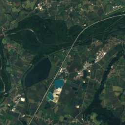
Satellite: Sentinel-2 cloudless 2016 by EOX IT Services GmbH · CC BY 4.0 · Contains modified Copernicus Sentinel data 2016

Trausnitz Castle

0.9 km NE
architectural heritage monument in Bavaria
Trausnitz Castle
Palace Etzdorf
Photo: Rufus46 · CC BY-SA 3.0 · Wikimedia CommonsReport this photo · linked, not stored

Palace Etzdorf

1.0 km NE
architectural heritage monument in Bavaria
Palace Etzdorf
Around here

Kumhausen and around

Kumhausen
Photo: Konrad Lackerbeck · Public domain · Wikimedia CommonsReport this photo · linked, not stored

Kumhausen

Bavaria · Germany
Jul–Sepbest months
25°July high
434 maltitude
Kumhausen

Nature

Sempt
Photo: Hihiman · CC BY-SA 3.0 · Wikimedia CommonsReport this photo · linked, not stored
11 km W

Sempt

River
Sempt
Pfettrach
Photo: Blutsauger666 · CC BY-SA 3.0 · Wikimedia CommonsReport this photo · linked, not stored
4.5 km N

Pfettrach

River
Pfettrach
Kleine Isar
Photo: Cookiemovies · CC BY-SA 3.0 · Wikimedia CommonsReport this photo · linked, not stored
5.7 km N

Kleine Isar

River
Kleine Isar

Mountains

Gatterberge
Photo: wolfgangcyrus68 · CC BY-SA 3.0 de · Wikimedia CommonsReport this photo · linked, not stored
31 km S

Gatterberge

618 m
Gatterberge
Kapellenberg Ergoldsbach
Photo: LowerBavaria (talk) 16:02, 16 June 2009 (UTC) · Public domain · Wikimedia CommonsReport this photo · linked, not stored
21 km N

Kapellenberg Ergoldsbach

464 m
Kapellenberg Ergoldsbach
Satellite: Sentinel-2 cloudless 2016 by EOX IT Services GmbH · CC BY 4.0 · Contains modified Copernicus Sentinel data 2016
25 km SW

Weißberg NE von Hangenham

460 m
Weißberg NE von Hangenham

Heritage

St. Martin's Church, Kumhausen
Photo: Jhbrady · CC BY-SA 3.0 · Wikimedia CommonsReport this photo · linked, not stored
2.8 km N

St. Martin's Church, Kumhausen

architectural heritage monument in Bavaria · 1389
St. Martin's Church, Kumhausen
Alt St. Margareta
Photo: Gliwi · CC BY-SA 3.0 · Wikimedia CommonsReport this photo · linked, not stored
1.8 km NW

Alt St. Margareta

architectural heritage monument in Bavaria · 1909
Alt St. Margareta
Theklakapelle (Landshut)
Photo: Rufus46 · CC BY-SA 3.0 · Wikimedia CommonsReport this photo · linked, not stored
2.5 km N

Theklakapelle (Landshut)

architectural heritage monument in Bavaria · 1426
Theklakapelle (Landshut)

Museums

KOENIGmuseum
Photo: Rosa-Maria Rinkl · CC BY-SA 4.0 · Wikimedia CommonsReport this photo · linked, not stored
2.7 km N

KOENIGmuseum

Artist museum · 1998
KOENIGmuseum
Chamber of Art and Curiosities
Photo: Stefan Karl · CC BY-SA 4.0 · Wikimedia CommonsReport this photo · linked, not stored
2.5 km N

Chamber of Art and Curiosities

History museum
Chamber of Art and Curiosities
LANDSHUTmuseum
Photo: Gliwi · CC BY-SA 3.0 · Wikimedia CommonsReport this photo · linked, not stored
2.8 km N

LANDSHUTmuseum

City museum · 1999
LANDSHUTmuseum