Skip to content
Destinations
Weather & climate
Nature
Outdoors
Culture
Events
Sky & live
Riesschule
Photo: Exprimidor · CC BY-SA 4.0 · Wikimedia Commons
RiesschuleReport this photo · linked, not stored
Wohn- und Wirtschaftsgebäude Riesstraße 42
Photo: Exprimidor · CC BY-SA 4.0 · Wikimedia Commons
Wohn- und Wirtschaftsgebäude Riesstraße 42Report this photo · linked, not stored
Wohn- und Wirtschaftsgebäude Riesstraße 42
Rathaus Ritterhude
Photo: Exprimidor · CC BY-SA 4.0 · Wikimedia Commons
Rathaus RitterhudeReport this photo · linked, not stored
Rathaus Ritterhude
Apotheke Riesstraße 68
Photo: Exprimidor · CC BY-SA 4.0 · Wikimedia Commons
Apotheke Riesstraße 68Report this photo · linked, not stored
Apotheke Riesstraße 68
Ries-Turnhalle
Photo: Jürgen Howaldt · CC BY-SA 3.0 de · Wikimedia Commons
Ries-TurnhalleReport this photo · linked, not stored
Ries-Turnhalle
schoolRitterhude, Lower Saxony

Riesschule

cultural heritage monument in Lower Saxony
Typeschool
Built–
Best monthsMay–Jun · Sepweather in Ritterhude
53.18° N, 8.75° EUTC+1 · Central European Standard Time
When to goRitterhude · weather score
JanFebMarAprMayJunJulAugSepOctNovDec39October
Best timeMay–Jun · Sep
October: high / low14° / 6°
iAbout

Riesschule in brief

Riesschule is a school in Ritterhude, Lower Saxony, Germany.

It holds the designation cultural heritage monument in Lower Saxony.

For a visit, the weather in Ritterhude is best in May, June and September; in October afternoons average 14°.

Ritterhude: weather and travel guide

Facts

Type
school
Designation
cultural heritage monument in Lower Saxony
Nearest town
Ritterhude
Region
Lower Saxony
Coordinates
53.17998, 8.75089
iiLocation

Where to find it

iiiWhen to visit

Weather in Ritterhude

Climate guide

Month score for sightseeing

Best May–Jun · Sep
14
Jan
21
Feb
24
Mar
53
Apr
69
May
64
Jun
64
Jul
64
Aug
66
Sep
39
Oct
15
Nov
13
Dec
ivNearby

More heritage close by

All monuments in Germany
Wohn- und Wirtschaftsgebäude Riesstraße 42
Photo: Exprimidor · CC BY-SA 4.0 · Wikimedia CommonsReport this photo · linked, not stored

Wohn- und Wirtschaftsgebäude Riesstraße 42

under 100 m SE
cultural heritage monument in Lower Saxony
Wohn- und Wirtschaftsgebäude Riesstraße 42
Rathaus Ritterhude
Photo: Exprimidor · CC BY-SA 4.0 · Wikimedia CommonsReport this photo · linked, not stored

Rathaus Ritterhude

under 100 m S
cultural heritage monument in Lower Saxony
Rathaus Ritterhude
Apotheke Riesstraße 68
Photo: Exprimidor · CC BY-SA 4.0 · Wikimedia CommonsReport this photo · linked, not stored

Apotheke Riesstraße 68

under 100 m S
cultural heritage monument in Lower Saxony
Apotheke Riesstraße 68
Ries-Turnhalle
Photo: Jürgen Howaldt · CC BY-SA 3.0 de · Wikimedia CommonsReport this photo · linked, not stored

Ries-Turnhalle

0.1 km E
cultural heritage monument in Lower Saxony
Ries-Turnhalle
Pfarrhaus Riesstraße 27
Photo: Exprimidor · CC BY-SA 4.0 · Wikimedia CommonsReport this photo · linked, not stored

Pfarrhaus Riesstraße 27

0.1 km SE
cultural heritage monument in Lower Saxony
Pfarrhaus Riesstraße 27
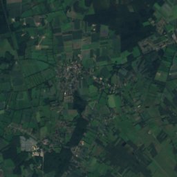
Satellite: Sentinel-2 cloudless 2016 by EOX IT Services GmbH · CC BY 4.0 · Contains modified Copernicus Sentinel data 2016

St. Johanneskirche (Ritterhude)

0.2 km E
cultural heritage monument in Lower Saxony
St. Johanneskirche (Ritterhude)
Around here

Ritterhude and around

Ritterhude
Photo: Florean Fortescue · Public domain · Wikimedia CommonsReport this photo · linked, not stored

Ritterhude

Lower Saxony · Germany
May–Jun · Sepbest months
23°July high
28 maltitude
Ritterhude

Nature

Wümme
Photo: Heinz-Josef Lücking · CC BY-SA 3.0 de · Wikimedia CommonsReport this photo · linked, not stored
1.4 km S

Wümme

River
Wümme
Drepte
Photo: Smarties · CC BY-SA 4.0 · Wikimedia CommonsReport this photo · linked, not stored
7.5 km N

Drepte

River · 46 m
Drepte
Ochtum
Photo: C. Löser · CC BY 3.0 de · Wikimedia CommonsReport this photo · linked, not stored
8.6 km SW

Ochtum

River
Ochtum

Mountains

Hoher Berg, Syke
Photo: Bin im Garten · CC BY-SA 3.0 · Wikimedia CommonsReport this photo · linked, not stored
28 km S

Hoher Berg, Syke

58 m
Hoher Berg, Syke
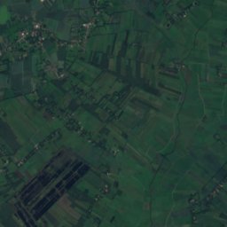
Satellite: Sentinel-2 cloudless 2016 by EOX IT Services GmbH · CC BY 4.0 · Contains modified Copernicus Sentinel data 2016
13 km E

Weyerberg

54 m
Weyerberg

Heritage

Kirche Wasserhorst
Photo: Ulamm (talk) · CC BY-SA 4.0 · Wikimedia CommonsReport this photo · linked, not stored
2.2 km S

Kirche Wasserhorst

protected cultural heritage monument in Bremen (state)
Kirche Wasserhorst
Schule Landskronastrasse
Photo: HVL2.0 (talk) · CC BY-SA 4.0 · Wikimedia CommonsReport this photo · linked, not stored
1.1 km SW

Schule Landskronastrasse

protected cultural heritage monument in Bremen (state)
Schule Landskronastrasse
Rathaus Ritterhude
Photo: Exprimidor · CC BY-SA 4.0 · Wikimedia CommonsReport this photo · linked, not stored
1.1 km E

Rathaus Ritterhude

cultural heritage monument in Lower Saxony
Rathaus Ritterhude

Museums

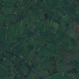
Satellite: Sentinel-2 cloudless 2016 by EOX IT Services GmbH · CC BY 4.0 · Contains modified Copernicus Sentinel data 2016
2.4 km SW

Köksch un Qualm

Köksch un Qualm
Kunsthalle Bremen
Photo: Dguendel · CC BY 4.0 · Wikimedia CommonsReport this photo · linked, not stored
13 km SE

Kunsthalle Bremen

Art museum · 1823
Kunsthalle Bremen
Universum Science Center
Photo: User:Matthias Süßen · CC BY-SA 3.0 · Wikimedia CommonsReport this photo · linked, not stored
11 km SE

Universum Science Center

Science center · 2000
Universum Science Center