Skip to content
Destinations
Weather & climate
Nature
Outdoors
Culture
Events
Sky & live
Ottofelsen
Photo: Dennis Siebert at German Wikipedia · CC BY-SA 3.0 · Wikimedia Commons
OttofelsenReport this photo · linked, not stored
Gebohrter Stein
Photo: w:de:User:Hejkal · CC BY-SA 3.0 de · Wikimedia Commons
Gebohrter SteinReport this photo · linked, not stored
Gebohrter Stein
Aufgeklärtes Glück mine
Photo: Benutzer:Hejkal · CC BY-SA 2.0 de · Wikimedia Commons
Aufgeklärtes Glück mineReport this photo · linked, not stored
Aufgeklärtes Glück mine
Steinerne Renne
Photo: Dampftrain · CC BY-SA 3.0 · Wikimedia Commons
Steinerne RenneReport this photo · linked, not stored
Steinerne Renne
Lossen-Denkmal
Photo: Benutzer:Hejkal · CC BY-SA 3.0 · Wikimedia Commons
Lossen-DenkmalReport this photo · linked, not stored
Lossen-Denkmal
rock formationDarlingerode, Saxony-Anhalt

Ottofelsen

natural monument in Germany
Typerock formation
Built–
Best monthsMay · Aug–Sepweather in Darlingerode
51.80° N, 10.71° EUTC+1 · Central European Standard Time
When to goDarlingerode · weather score
JanFebMarAprMayJunJulAugSepOctNovDec43October
Best timeMay · Aug–Sep
October: high / low13° / 6°
iAbout

Ottofelsen in brief

Ottofelsen is a rock formation in Darlingerode, Saxony-Anhalt, Germany.

It holds the designation natural monument in Germany.

For a visit, the weather in Darlingerode is best in May, August and September; in October afternoons average 13°.

Darlingerode: weather and travel guide

Facts

Type
rock formation
Designation
natural monument in Germany
Nearest town
Darlingerode
Region
Saxony-Anhalt
Coordinates
51.79680, 10.71190
iiLocation

Where to find it

iiiWhen to visit

Weather in Darlingerode

Climate guide

Month score for sightseeing

Best May · Aug–Sep
16
Jan
25
Feb
24
Mar
52
Apr
68
May
68
Jun
65
Jul
69
Aug
72
Sep
43
Oct
21
Nov
13
Dec
ivNearby

More heritage close by

All monuments in Germany
Gebohrter Stein
Photo: w:de:User:Hejkal · CC BY-SA 3.0 de · Wikimedia CommonsReport this photo · linked, not stored

Gebohrter Stein

0.7 km NW
natural monument
Gebohrter Stein
Aufgeklärtes Glück mine
Photo: Benutzer:Hejkal · CC BY-SA 2.0 de · Wikimedia CommonsReport this photo · linked, not stored

Aufgeklärtes Glück mine

1.5 km NE
Kulturdenkmal
Aufgeklärtes Glück mine
Steinerne Renne
Photo: Dampftrain · CC BY-SA 3.0 · Wikimedia CommonsReport this photo · linked, not stored

Steinerne Renne

1.8 km N
single natural monument in Saxony-Anahlt
Steinerne Renne
Lossen-Denkmal
Photo: Benutzer:Hejkal · CC BY-SA 3.0 · Wikimedia CommonsReport this photo · linked, not stored

Lossen-Denkmal

2.2 km NE
heritage monument in Saxony-Anhalt
Lossen-Denkmal
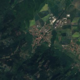
Satellite: Sentinel-2 cloudless 2016 by EOX IT Services GmbH · CC BY 4.0 · Contains modified Copernicus Sentinel data 2016

Mönchsbuche

2.4 km N
natural monument in Germany
Mönchsbuche
Wormsgraben
Photo: Krajo · CC BY-SA 3.0 · Wikimedia CommonsReport this photo · linked, not stored

Wormsgraben

2.8 km S
Kulturdenkmal
Wormsgraben
Around here

Darlingerode and around

Darlingerode
Photo: Wolboe · CC BY-SA 4.0 · Wikimedia CommonsReport this photo · linked, not stored

Darlingerode

Saxony-Anhalt · Germany
May · Aug–Sepbest months
24°July high
266 maltitude
Darlingerode

Nature

Ilse (Oker)
Photo: Dietmar Rabich · CC BY-SA 4.0 · Wikimedia CommonsReport this photo · linked, not stored
9.3 km SW

Ilse (Oker)

River
Ilse (Oker)
Zillierbach
Photo: Z thomas · CC BY-SA 4.0 · Wikimedia CommonsReport this photo · linked, not stored
3.6 km SE

Zillierbach

River
Zillierbach
Steinerne Renne
Photo: Dampftrain · CC BY-SA 3.0 · Wikimedia CommonsReport this photo · linked, not stored
4.1 km S

Steinerne Renne

Waterfall
Steinerne Renne

Mountains

Brocken
Photo: Rosa-Maria Rinkl · CC BY-SA 4.0 · Wikimedia CommonsReport this photo · linked, not stored
9.6 km SW

Brocken

1,141 m · Harz
Brocken
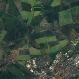
Satellite: Sentinel-2 cloudless 2016 by EOX IT Services GmbH · CC BY 4.0 · Contains modified Copernicus Sentinel data 2016
9.5 km SW

Heinrichshöhe

1,045 m · Harz
Heinrichshöhe
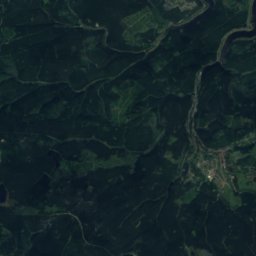
Satellite: Sentinel-2 cloudless 2016 by EOX IT Services GmbH · CC BY 4.0 · Contains modified Copernicus Sentinel data 2016
11 km SW

Königsberg (Brocken)

1,034 m · Harz
Königsberg (Brocken)

Heritage

Drübeck Abbey
Photo: Benutzer:Hejkal · CC BY-SA 3.0 de · Wikimedia CommonsReport this photo · linked, not stored
1.5 km NW

Drübeck Abbey

heritage monument in Saxony-Anhalt · 901
Drübeck Abbey
St. Bartholomäus (Drübeck)
Photo: Olaf Meister · CC BY-SA 3.0 · Wikimedia CommonsReport this photo · linked, not stored
1.3 km NW

St. Bartholomäus (Drübeck)

Kulturdenkmal
St. Bartholomäus (Drübeck)
St. Katharinen (Darlingerode)
Photo: Olaf Meister · CC BY-SA 3.0 · Wikimedia CommonsReport this photo · linked, not stored
0.5 km NE

St. Katharinen (Darlingerode)

Kulturdenkmal
St. Katharinen (Darlingerode)

Museums

Museum für Luftfahrt und Technik
Photo: Major18 · CC0 · Wikimedia CommonsReport this photo · linked, not stored
3.0 km E

Museum für Luftfahrt und Technik

Aviation museum · 1999
Museum für Luftfahrt und Technik
Harzmuseum Wernigerode
Photo: Luha · CC BY-SA 3.0 · Wikimedia CommonsReport this photo · linked, not stored
3.9 km SE

Harzmuseum Wernigerode

Harzmuseum Wernigerode
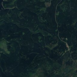
Satellite: Sentinel-2 cloudless 2016 by EOX IT Services GmbH · CC BY 4.0 · Contains modified Copernicus Sentinel data 2016
0.5 km S

Heimatstube Darlingerode

Heimatstube Darlingerode