Skip to content
Destinations
Weather & climate
Nature
Outdoors
Culture
Events
Sky & live
Hallthurm
Photo: Gamsjaga · Public domain · Wikimedia Commons
HallthurmReport this photo · linked, not stored
Burgruine Plainburg
Photo: Alupus · CC BY-SA 3.0 · Wikimedia Commons
Burgruine PlainburgReport this photo · linked, not stored
Burgruine Plainburg
Marienbrunnen Großgmain
Photo: Benutzer:Chatter · CC BY-SA 3.0 · Wikimedia Commons
Marienbrunnen GroßgmainReport this photo · linked, not stored
Marienbrunnen Großgmain
Großgmain - Our Lady church
Photo: Alupus · CC BY-SA 3.0 · Wikimedia Commons
Großgmain - Our Lady churchReport this photo · linked, not stored
Großgmain - Our Lady church
Schloss Oberhausen (Bayerisch Gmain)
Photo: Luitold · CC BY-SA 3.0 · Wikimedia Commons
Schloss Oberhausen (Bayerisch Gmain)Report this photo · linked, not stored
Schloss Oberhausen (Bayerisch Gmain)
mountain passBayerisch Gmain, Bavaria

Hallthurm

architectural heritage monument in Bavaria
Typemountain pass
Built–
Best monthsJul–Sepweather in Bayerisch Gmain
47.70° N, 12.93° EUTC+1 · Central European Standard Time
When to goBayerisch Gmain · weather score
JanFebMarAprMayJunJulAugSepOctNovDec46October
Best timeJul–Sep
October: high / low15° / 5°
iAbout

Hallthurm in brief

Hallthurm is a mountain pass in Bayerisch Gmain, Bavaria, Germany.

It holds the designation architectural heritage monument in Bavaria.

For a visit, the weather in Bayerisch Gmain is best in July, August and September; in October afternoons average 15°.

Bayerisch Gmain: weather and travel guide

Facts

Type
mountain pass
Designation
architectural heritage monument in Bavaria
Nearest town
Bayerisch Gmain
Region
Bavaria
Coordinates
47.70140, 12.93360
iiLocation

Where to find it

iiiWhen to visit

Weather in Bayerisch Gmain

Climate guide

Month score for sightseeing

Best Jul–Sep
20
Jan
22
Feb
18
Mar
53
Apr
62
May
62
Jun
64
Jul
64
Aug
63
Sep
46
Oct
24
Nov
18
Dec
ivNearby

More heritage close by

All monuments in Germany
Satellite: Sentinel-2 cloudless 2016 by EOX IT Services GmbH · CC BY 4.0 · Contains modified Copernicus Sentinel data 2016

Steinerne Agnes

2.5 km SW
natural monument in Germany
Steinerne Agnes
Burgruine Plainburg
Photo: Alupus · CC BY-SA 3.0 · Wikimedia CommonsReport this photo · linked, not stored

Burgruine Plainburg

2.8 km N
Listed objects in Austria
Burgruine Plainburg
Marienbrunnen Großgmain
Photo: Benutzer:Chatter · CC BY-SA 3.0 · Wikimedia CommonsReport this photo · linked, not stored

Marienbrunnen Großgmain

3.3 km NW
Listed objects in Austria
Marienbrunnen Großgmain
Großgmain - Our Lady church
Photo: Alupus · CC BY-SA 3.0 · Wikimedia CommonsReport this photo · linked, not stored

Großgmain - Our Lady church

3.3 km NW
Listed objects in Austria
Großgmain - Our Lady church
Schloss Oberhausen (Bayerisch Gmain)
Photo: Luitold · CC BY-SA 3.0 · Wikimedia CommonsReport this photo · linked, not stored

Schloss Oberhausen (Bayerisch Gmain)

3.5 km NW
architectural heritage monument in Bavaria
Schloss Oberhausen (Bayerisch Gmain)
Berchtesgadener Straße 5
Photo: Luitold · CC BY-SA 3.0 · Wikimedia CommonsReport this photo · linked, not stored

Berchtesgadener Straße 5

3.9 km NW
former architectural heritage monument in Bavaria
Berchtesgadener Straße 5
Around here

Bayerisch Gmain and around

Bayerisch Gmain
Photo: Nikater · CC BY-SA 3.0 · Wikimedia CommonsReport this photo · linked, not stored

Bayerisch Gmain

Bavaria · Germany
Jul–Sepbest months
25°July high
553 maltitude
Bayerisch Gmain

Nature

Höglwörther See
Photo: Thomas Then · CC BY 3.0 · Wikimedia CommonsReport this photo · linked, not stored
12 km N

Höglwörther See

Lake · 532 m
Höglwörther See
Frillen-See
Photo: Peter Becker · CC BY-SA 3.0 · Wikimedia CommonsReport this photo · linked, not stored
8.3 km NW

Frillen-See

Lake · 922 m
Frillen-See
Riesending cave
Photo: Bayerisches Rotes Kreuz, Kreisverband Berchtesgadener Land · Attribution · Wikimedia CommonsReport this photo · linked, not stored
6.5 km E

Riesending cave

Cave · 1,843 m
Riesending cave

Mountains

Hochkönig
Photo: StVeit Maps · CC BY-SA 4.0 · Wikimedia CommonsReport this photo · linked, not stored
35 km S

Hochkönig

2,941 m · Hochkönig mountain range
Hochkönig
Hohe Köpfe, Salzburg
Photo: Tigerente · CC BY-SA 4.0 · Wikimedia CommonsReport this photo · linked, not stored
35 km S

Hohe Köpfe, Salzburg

2,875 m · Hochkönig mountain range
Hohe Köpfe, Salzburg
Bratschenköpfe
Photo: Thorsten Hartmann · CC BY-SA 3.0 · Wikimedia CommonsReport this photo · linked, not stored
36 km S

Bratschenköpfe

2,857 m · Hochkönig mountain range
Bratschenköpfe

Heritage

Heilingbrunner School
Photo: Luitold · CC BY-SA 3.0 · Wikimedia CommonsReport this photo · linked, not stored
1.7 km NW

Heilingbrunner School

architectural heritage monument in Bavaria · 1908
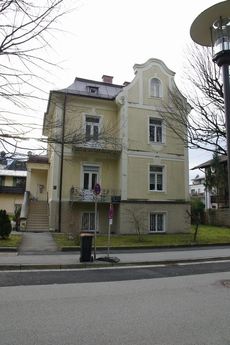
Heilingbrunner School
Berchtesgadener Straße 5
Photo: Luitold · CC BY-SA 3.0 · Wikimedia CommonsReport this photo · linked, not stored
0.9 km NW

Berchtesgadener Straße 5

former architectural heritage monument in Bavaria
Berchtesgadener Straße 5
Villa Isolde
Photo: Luitold · CC BY-SA 4.0 · Wikimedia CommonsReport this photo · linked, not stored
2.4 km NW

Villa Isolde

architectural heritage monument in Bavaria · 1899
Villa Isolde

Museums

ReichenhallMuseum
Photo: Luitold · CC BY-SA 3.0 · Wikimedia CommonsReport this photo · linked, not stored
2.0 km NW

ReichenhallMuseum

Regional museum
ReichenhallMuseum
Satellite: Sentinel-2 cloudless 2016 by EOX IT Services GmbH · CC BY 4.0 · Contains modified Copernicus Sentinel data 2016
1.8 km W

Bad Reichenhaller Salzmuseum

Industry museum
Bad Reichenhaller Salzmuseum
Residenzgalerie Salzburg
Photo: Andrew Bossi · CC BY-SA 2.5 · Wikimedia CommonsReport this photo · linked, not stored
14 km NE

Residenzgalerie Salzburg

Art museum
Residenzgalerie Salzburg