
Photo: Dietmar Rabich · CC BY-SA 4.0 · Wikimedia Commons
Former synagogueReport this photo · linked, not stored
Former synagogueReport this photo · linked, not stored

Photo: Norbert Schnitzler · CC BY-SA 3.0 · Wikimedia Commons
Weißer Turm, Bad Neuenahr-AhrweilerReport this photo · linked, not stored
Weißer Turm, Bad Neuenahr-AhrweilerWeißer Turm, Bad Neuenahr-AhrweilerReport this photo · linked, not stored

Photo: =GFreihalter · CC BY-SA 3.0 · Wikimedia Commons
Pfarrhaus (Ahrweiler)Report this photo · linked, not stored
Pfarrhaus (Ahrweiler)Pfarrhaus (Ahrweiler)Report this photo · linked, not stored

Photo: Dietmar Rabich · CC BY-SA 4.0 · Wikimedia Commons
St. Laurentius, Bad Neuenahr-AhrweilerReport this photo · linked, not stored
St. Laurentius, Bad Neuenahr-AhrweilerSt. Laurentius, Bad Neuenahr-AhrweilerReport this photo · linked, not stored

Photo: GFreihalter · CC BY-SA 3.0 · Wikimedia Commons
StadtwacheReport this photo · linked, not stored
StadtwacheStadtwacheReport this photo · linked, not stored
synagogueBad Neuenahr-Ahrweiler, Rheinland-Pfalz
Former synagogue
cultural heritage monument in Rhineland-PalatinateBuilt 1894
Typesynagogue
Built1894
Best monthsJul–Sepweather in Bad Neuenahr-Ahrweiler
50.54° N, 7.09° EUTC+2 · Central European Summer Time
Standing for132 years
built 1894today 2026
When to goBad Neuenahr-Ahrweiler · weather score
Best timeJul–Sep
October: high / low15° / 7°
iAbout
Former synagogue in brief
Former synagogue is a synagogue in Bad Neuenahr-Ahrweiler, Rheinland-Pfalz, Germany. Hall building made of ashlar masonry in Ahrweiler, Rhineland-Palatinate.
It holds the designation cultural heritage monument in Rhineland-Palatinate.
The synagogue dates from 1894.
For a visit, the weather in Bad Neuenahr-Ahrweiler is best in July, August and September; in October afternoons average 15°.
Facts
- Type
- synagogue
- Designation
- cultural heritage monument in Rhineland-Palatinate
- Built
- 1894
- Nearest town
- Bad Neuenahr-Ahrweiler
- Region
- Rheinland-Pfalz
- Coordinates
- 50.54140, 7.09288
iiLocation
Where to find it
ivNearby
All monuments in GermanyMore heritage close by
Weißer Turm, Bad Neuenahr-Ahrweiler
under 100 m NW
cultural heritage monument in Rhineland-Palatinate
Pfarrhaus (Ahrweiler)
0.1 km NE
cultural heritage monument in Rhineland-Palatinate
St. Laurentius, Bad Neuenahr-Ahrweiler
0.1 km NE
cultural heritage monument in Rhineland-Palatinate


Photo: HOWI - Horsch, Willy · CC BY-SA 3.0 · Wikimedia CommonsReport this photo · linked, not stored
Adenbach Castle
0.3 km NE
cultural heritage monument in Rhineland-Palatinate
Around here
Bad Neuenahr-Ahrweiler and around

Bad Neuenahr-Ahrweiler
Rheinland-Pfalz · Germany
Jul–Sepbest months
25°July high
101 maltitude
Nature

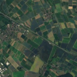
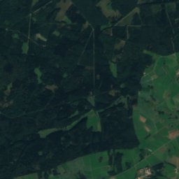
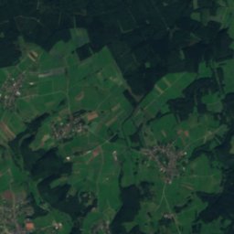
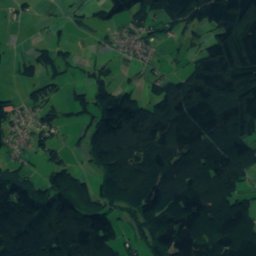
Satellite: Sentinel-2 cloudless 2016 by EOX IT Services GmbH · CC BY 4.0 · Contains modified Copernicus Sentinel data 2016
Swist
River

Mountains


Heritage

Rosenkranzkirche (Bad Neuenahr-Ahrweiler)
cultural heritage monument in Rhineland-Palatinate

Kurhaus Bad Neuenahr
cultural heritage monument in Rhineland-Palatinate · 1903

Walporzheim station
cultural heritage monument in Rhineland-Palatinate · 1886
Museums






Satellite: Sentinel-2 cloudless 2016 by EOX IT Services GmbH · CC BY 4.0 · Contains modified Copernicus Sentinel data 2016
Museum der Stadt Bad Neuenahr-Ahrweiler




Satellite: Sentinel-2 cloudless 2016 by EOX IT Services GmbH · CC BY 4.0 · Contains modified Copernicus Sentinel data 2016