Skip to content
Destinations
Weather & climate
Nature
Outdoors
Culture
Events
Sky & live
Flaucher
Photo: Schlaier · Public domain · Wikimedia Commons
FlaucherReport this photo · linked, not stored
München Isartal station
Photo: User:X · Public domain · Wikimedia Commons
München Isartal stationReport this photo · linked, not stored
München Isartal station
Alter Israelitischer Friedhof (Munich)
Photo: GFreihalter · CC BY-SA 3.0 · Wikimedia Commons
Alter Israelitischer Friedhof (Munich)Report this photo · linked, not stored
Alter Israelitischer Friedhof (Munich)
Grundschule am Agilolfingerplatz
Photo: Rufus46 · CC BY-SA 3.0 · Wikimedia Commons
Grundschule am AgilolfingerplatzReport this photo · linked, not stored
Grundschule am Agilolfingerplatz
Archiconvent der Templer
Photo: Bjs · CC BY-SA 3.0 · Wikimedia Commons
Archiconvent der TemplerReport this photo · linked, not stored
Archiconvent der Templer
recreation areaMunich, Bavaria

Flaucher

architectural heritage monument in Bavaria
Typerecreation area
Built–
Best monthsJul–Sepweather in Munich
48.11° N, 11.56° EUTC+1 · Central European Standard Time
When to goMunich · weather score
JanFebMarAprMayJunJulAugSepOctNovDec49October
Best timeJul–Sep
October: high / low14° / 5°
iAbout

Flaucher in brief

Flaucher is a recreation area in Munich, Bavaria, Germany.

It holds the designation architectural heritage monument in Bavaria.

For a visit, the weather in Munich is best in July, August and September; in October afternoons average 14°.

Munich: weather and travel guide

Facts

Type
recreation area
Designation
architectural heritage monument in Bavaria
Nearest town
Munich
Region
Bavaria
Coordinates
48.11054, 11.55673
iiLocation

Where to find it

iiiWhen to visit

Weather in Munich

Climate guide

Month score for sightseeing

Best Jul–Sep
ivNearby

More heritage close by

All monuments in Germany
München Isartal station
Photo: User:X · Public domain · Wikimedia CommonsReport this photo · linked, not stored

München Isartal station

0.8 km N
architectural heritage monument in Bavaria
München Isartal station
Alter Israelitischer Friedhof (Munich)
Photo: GFreihalter · CC BY-SA 3.0 · Wikimedia CommonsReport this photo · linked, not stored

Alter Israelitischer Friedhof (Munich)

0.8 km W
architectural heritage monument in Bavaria
Alter Israelitischer Friedhof (Munich)
Grundschule am Agilolfingerplatz
Photo: Rufus46 · CC BY-SA 3.0 · Wikimedia CommonsReport this photo · linked, not stored

Grundschule am Agilolfingerplatz

0.8 km NE
architectural heritage monument in Bavaria
Grundschule am Agilolfingerplatz
Archiconvent der Templer
Photo: Bjs · CC BY-SA 3.0 · Wikimedia CommonsReport this photo · linked, not stored

Archiconvent der Templer

0.9 km E
architectural heritage monument in Bavaria
Archiconvent der Templer
Gaststätte Großmarkthalle
Photo: Wawimuc · CC BY-SA 3.0 · Wikimedia CommonsReport this photo · linked, not stored

Gaststätte Großmarkthalle

0.9 km N
architectural heritage monument in Bavaria
Gaststätte Großmarkthalle
Braunauer Eisenbahnbrücke
Photo: Bjs · CC BY-SA 3.0 · Wikimedia CommonsReport this photo · linked, not stored

Braunauer Eisenbahnbrücke

0.9 km NE
architectural heritage monument in Bavaria
Braunauer Eisenbahnbrücke
Around here

Munich and around

Munich
Photo: Thomas Wolf, www.foto-tw.de · CC BY-SA 3.0 de · Wikimedia CommonsReport this photo · linked, not stored

Munich

Bavaria · Germany
Jul–Sepbest months
24°July high
524 maltitude
Munich

Nature

Hachinger Bach
Photo: Rufus46 · CC BY-SA 3.0 · Wikimedia CommonsReport this photo · linked, not stored
4.7 km SE

Hachinger Bach

River
Hachinger Bach
Schwabinger Bach
Photo: Rufus46 · CC BY-SA 3.0 · Wikimedia CommonsReport this photo · linked, not stored
5.3 km NE

Schwabinger Bach

River
Schwabinger Bach
Riemer See
Photo: Carsten Steger · CC BY-SA 4.0 · Wikimedia CommonsReport this photo · linked, not stored
9.7 km E

Riemer See

Lake · 530 m
Riemer See

Mountains

Taubenberg
Photo: Gras-Ober, Wikipedia/Wikimedia Commons (cc-by-sa-3.0) · CC BY-SA 3.0 · Wikimedia CommonsReport this photo · linked, not stored
37 km S

Taubenberg

896 m · Southern Alpine Foreland
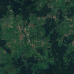
Taubenberg
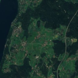
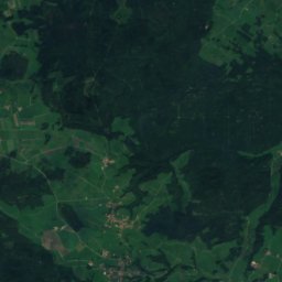
Satellite: Sentinel-2 cloudless 2016 by EOX IT Services GmbH · CC BY 4.0 · Contains modified Copernicus Sentinel data 2016
36 km SW

Berndorfer Buchet

760 m
Berndorfer Buchet
Ilkahöhe
Photo: Gras-Ober, Wikipedia/Wikimedia Commons (cc-by-sa-3.0) · CC BY-SA 3.0 · Wikimedia CommonsReport this photo · linked, not stored
36 km SW

Ilkahöhe

726 m
Ilkahöhe

Heritage

Frauenkirche, Munich
Photo: Diliff · CC BY 2.5 · Wikimedia CommonsReport this photo · linked, not stored
0.2 km NW

Frauenkirche, Munich

architectural heritage monument in Bavaria · 1401
Frauenkirche, Munich
New Town Hall, Munich
Photo: Burkhard Mücke · CC BY-SA 4.0 · Wikimedia CommonsReport this photo · linked, not stored
under 100 m NE

New Town Hall, Munich

architectural heritage monument in Bavaria · 1909
New Town Hall, Munich
Theatine Church
Photo: Wilfredor · CC0 · Wikimedia CommonsReport this photo · linked, not stored
0.5 km N

Theatine Church

architectural heritage monument in Bavaria · 1663
Theatine Church

Museums

Alte Pinakothek
Photo: Photo: Andreas Praefcke · CC BY 3.0 · Wikimedia CommonsReport this photo · linked, not stored
1.3 km N

Alte Pinakothek

Art museum · 1836
Alte Pinakothek
Neue Pinakothek
Photo: Bärwinkel,Klaus · CC BY 3.0 · Wikimedia CommonsReport this photo · linked, not stored
1.4 km N

Neue Pinakothek

Pinacotheca · 1853
Neue Pinakothek
Pinakothek der Moderne
Photo: Rufus46 · CC BY-SA 3.0 · Wikimedia CommonsReport this photo · linked, not stored
1.1 km N

Pinakothek der Moderne

Pinacotheca · 2002
Pinakothek der Moderne