Skip to content
Destinations
Weather & climate
Nature
Outdoors
Culture
Events
Sky & live
Burghaus, Igel
Photo: Killemgood · CC BY-SA 4.0 · Wikimedia Commons
Burghaus, IgelReport this photo · linked, not stored
Igel Column
Photo: Dkvtig · CC BY-SA 4.0 · Wikimedia Commons
Igel ColumnReport this photo · linked, not stored
Igel Column
St. Dionysius, Igel
Photo: Palauenc05 · CC BY-SA 4.0 · Wikimedia Commons
St. Dionysius, IgelReport this photo · linked, not stored
St. Dionysius, Igel
Aprus Church
Photo: Cornischong at Luxembourgish Wikipedia · CC BY-SA 1.0 · Wikimedia Commons
Aprus ChurchReport this photo · linked, not stored
Aprus Church
Löschemer Kapelle
Photo: MNHNL pbraun · CC0 · Wikimedia Commons
Löschemer KapelleReport this photo · linked, not stored
Löschemer Kapelle
built structureIgel, Rheinland-Pfalz

Burghaus, Igel

cultural heritage monument in Rhineland-Palatinate
Typebuilt structure
Built–
Best monthsJun–Jul · Sepweather in Igel
49.71° N, 6.55° EUTC+2 · Central European Summer Time
When to goIgel · weather score
JanFebMarAprMayJunJulAugSepOctNovDec45October
Best timeJun–Jul · Sep
October: high / low15° / 7°
iAbout

Burghaus, Igel in brief

Burghaus, Igel is a built structure in Igel, Rheinland-Pfalz, Germany.

It holds the designation cultural heritage monument in Rhineland-Palatinate.

For a visit, the weather in Igel is best in June, July and September; in October afternoons average 15°.

Igel: weather and travel guide

Facts

Type
built structure
Designation
cultural heritage monument in Rhineland-Palatinate
Nearest town
Igel
Region
Rheinland-Pfalz
Coordinates
49.70883, 6.54790
iiLocation

Where to find it

iiiWhen to visit

Weather in Igel

Climate guide

Month score for sightseeing

Best Jun–Jul · Sep
15
Jan
22
Feb
28
Mar
60
Apr
65
May
66
Jun
66
Jul
66
Aug
75
Sep
45
Oct
18
Nov
14
Dec
ivNearby

More heritage close by

All monuments in Germany
Igel Column
Photo: Dkvtig · CC BY-SA 4.0 · Wikimedia CommonsReport this photo · linked, not stored

Igel Column

0.1 km E
part of UNESCO World Heritage Site
Igel Column
St. Dionysius, Igel
Photo: Palauenc05 · CC BY-SA 4.0 · Wikimedia CommonsReport this photo · linked, not stored

St. Dionysius, Igel

0.1 km NE
architectural heritage monument
St. Dionysius, Igel
Aprus Church
Photo: Cornischong at Luxembourgish Wikipedia · CC BY-SA 1.0 · Wikimedia CommonsReport this photo · linked, not stored

Aprus Church

0.6 km W
Kulturdenkmal
Aprus Church
Löschemer Kapelle
Photo: MNHNL pbraun · CC0 · Wikimedia CommonsReport this photo · linked, not stored

Löschemer Kapelle

1.2 km SW
Kulturdenkmal
Löschemer Kapelle
Grutenhäuschen Igel (Roman tomb)
Photo: Holger Weinandt · CC BY-SA 3.0 de · Wikimedia CommonsReport this photo · linked, not stored

Grutenhäuschen Igel (Roman tomb)

1.4 km NW
Kulturdenkmal
Grutenhäuschen Igel (Roman tomb)
Zewener Turm
Photo: Palauenc05 · CC BY-SA 4.0 · Wikimedia CommonsReport this photo · linked, not stored

Zewener Turm

2.1 km E
Kulturdenkmal
Zewener Turm
Around here

Igel and around

Igel
Photo: Dkvtig · CC BY-SA 4.0 · Wikimedia CommonsReport this photo · linked, not stored

Igel

Rheinland-Pfalz · Germany
Jun–Jul · Sepbest months
25°July high
155 maltitude
Igel

Nature

Sauer, Rheinland-Pfalz
Photo: GilPe · CC BY-SA 4.0 · Wikimedia CommonsReport this photo · linked, not stored
3.5 km W

Sauer, Rheinland-Pfalz

River
Sauer, Rheinland-Pfalz
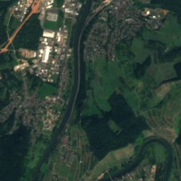
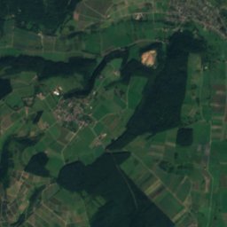
Satellite: Sentinel-2 cloudless 2016 by EOX IT Services GmbH · CC BY 4.0 · Contains modified Copernicus Sentinel data 2016
1.5 km SE

Saar, Rheinland-Pfalz

River
Saar, Rheinland-Pfalz
Gillenbach, Rheinland-Pfalz
Photo: HelgeRieder · CC BY-SA 4.0 · Wikimedia CommonsReport this photo · linked, not stored
7.9 km NE

Gillenbach, Rheinland-Pfalz

River
Gillenbach, Rheinland-Pfalz

Mountains

Erbeskopf
Photo: Jörg Braukmann · CC BY-SA 4.0 · Wikimedia CommonsReport this photo · linked, not stored
38 km E

Erbeskopf

816 m · Hunsrück
Erbeskopf
Ruppelstein
Photo: Unimog404 · CC BY-SA 3.0 · Wikimedia CommonsReport this photo · linked, not stored
36 km E

Ruppelstein

763 m · Black Forest High Forest
Ruppelstein
Sandkopf
Photo: Muck · CC BY-SA 4.0 · Wikimedia CommonsReport this photo · linked, not stored
34 km E

Sandkopf

757 m · Black Forest High Forest
Sandkopf

Heritage

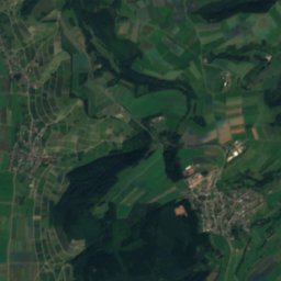
Satellite: Sentinel-2 cloudless 2016 by EOX IT Services GmbH · CC BY 4.0 · Contains modified Copernicus Sentinel data 2016
0.4 km W

Igel Column

part of UNESCO World Heritage Site
Igel Column
Protestant Church, Konz
Photo: HelgeRieder · CC BY-SA 3.0 · Wikimedia CommonsReport this photo · linked, not stored
2.2 km E

Protestant Church, Konz

Kulturdenkmal
Protestant Church, Konz
St. Dionysius, Igel
Photo: Palauenc05 · CC BY-SA 4.0 · Wikimedia CommonsReport this photo · linked, not stored
0.4 km W

St. Dionysius, Igel

architectural heritage monument · 1760
St. Dionysius, Igel

Museums

Roscheider Hof Open Air Museum
Photo: D. Witter-Rieder · CC BY-SA 3.0 · Wikimedia CommonsReport this photo · linked, not stored
3.1 km E

Roscheider Hof Open Air Museum

Open-air museum · 1976
Roscheider Hof Open Air Museum
Treasury of the Cathedral of Trier
Photo: Kleon3 · CC BY-SA 4.0 · Wikimedia CommonsReport this photo · linked, not stored
8.2 km NE

Treasury of the Cathedral of Trier

1200
Treasury of the Cathedral of Trier
Rheinisches Landesmuseum Trier
Photo: Berthold Werner · Public domain · Wikimedia CommonsReport this photo · linked, not stored
7.9 km NE

Rheinisches Landesmuseum Trier

1877
Rheinisches Landesmuseum Trier