Skip to content
Destinations
Weather & climate
Nature
Outdoors
Culture
Events
Sky & live
Barbara Baths
Photo: Stefan Kühn · CC BY-SA 3.0 · Wikimedia Commons
Barbara BathsReport this photo · linked, not stored
Roman Monuments, Cathedral of St. Peter and Church of Our Lady in Trier UNESCO World Heritage Site
Photo: Berthold Werner · CC BY-SA 3.0 · Wikimedia Commons
Roman Monuments, Cathedral of St. Peter and Church of Our Lady in Trier UNESCO World Heritage SiteReport this photo · linked, not stored
Roman Monuments, Cathedral of St. Peter and Church of Our Lady in Trier UNESCO World Heritage Site
Hochbunker, Trier
Photo: Berthold Werner · CC BY-SA 4.0 · Wikimedia Commons
Hochbunker, TrierReport this photo · linked, not stored
Hochbunker, Trier
Pegelhaus, Trier
Photo: Palauenc05 · CC BY-SA 4.0 · Wikimedia Commons
Pegelhaus, TrierReport this photo · linked, not stored
Pegelhaus, Trier
Humboldt-Gymnasium Trier
Photo: Berthold Werner · CC BY-SA 3.0 · Wikimedia Commons
Humboldt-Gymnasium TrierReport this photo · linked, not stored
Humboldt-Gymnasium Trier
ancient Roman structureTrier, Rheinland-Pfalz

Barbara Baths

part of UNESCO World Heritage SiteKulturdenkmal
Typeancient Roman structure
Built–
Best monthsMay–Jun · Sepweather in Trier
49.75° N, 6.63° EUTC+2 · Central European Summer Time
When to goTrier · weather score
JanFebMarAprMayJunJulAugSepOctNovDec47October
Best timeMay–Jun · Sep
October: high / low15° / 7°
iAbout

Barbara Baths in brief

Barbara Baths is an ancient roman structure in Trier, Rheinland-Pfalz, Germany.

It holds the designations part of UNESCO World Heritage Site and Kulturdenkmal.

For a visit, the weather in Trier is best in May, June and September; in October afternoons average 15°.

Trier: weather and travel guide

Facts

Type
ancient Roman structure
Designation
part of UNESCO World Heritage Site
Kulturdenkmal
Nearest town
Trier
Region
Rheinland-Pfalz
Coordinates
49.75000, 6.63028
iiLocation

Where to find it

iiiWhen to visit

Weather in Trier

Climate guide

Month score for sightseeing

Best May–Jun · Sep
ivNearby

More heritage close by

All monuments in Germany
Roman Monuments, Cathedral of St. Peter and Church of Our Lady in Trier UNESCO World Heritage Site
Photo: Berthold Werner · CC BY-SA 3.0 · Wikimedia CommonsReport this photo · linked, not stored

Roman Monuments, Cathedral of St. Peter and Church of Our Lady in Trier UNESCO World Heritage Site

0.2 km E
World Heritage Site
Roman Monuments, Cathedral of St. Peter and Church of Our Lady in Trier UNESCO World Heritage Site
Hochbunker, Trier
Photo: Berthold Werner · CC BY-SA 4.0 · Wikimedia CommonsReport this photo · linked, not stored

Hochbunker, Trier

0.3 km NE
Kulturdenkmal
Hochbunker, Trier
Pegelhaus, Trier
Photo: Palauenc05 · CC BY-SA 4.0 · Wikimedia CommonsReport this photo · linked, not stored

Pegelhaus, Trier

0.3 km NW
cultural heritage monument in Rhineland-Palatinate
Pegelhaus, Trier
Satellite: Sentinel-2 cloudless 2016 by EOX IT Services GmbH · CC BY 4.0 · Contains modified Copernicus Sentinel data 2016

Roman Bridge

0.3 km NW
part of UNESCO World Heritage Site
Roman Bridge
Humboldt-Gymnasium Trier
Photo: Berthold Werner · CC BY-SA 3.0 · Wikimedia CommonsReport this photo · linked, not stored

Humboldt-Gymnasium Trier

0.3 km NE
cultural heritage monument in Rhineland-Palatinate
Humboldt-Gymnasium Trier
Augustinerkirche St. Katharina (Trier)
Photo: Chris06 · CC BY-SA 3.0 · Wikimedia CommonsReport this photo · linked, not stored

Augustinerkirche St. Katharina (Trier)

0.4 km NE
Kulturdenkmal
Augustinerkirche St. Katharina (Trier)
Around here

Trier and around

Trier
Photo: Wolkenkratzer · CC BY-SA 4.0 · Wikimedia CommonsReport this photo · linked, not stored

Trier

Rheinland-Pfalz · Germany
May–Jun · Sepbest months
25°July high
141 maltitude
Trier

Nature

Sauer, Rheinland-Pfalz
Photo: GilPe · CC BY-SA 4.0 · Wikimedia CommonsReport this photo · linked, not stored
11 km SW

Sauer, Rheinland-Pfalz

River
Sauer, Rheinland-Pfalz
Kyll
Photo: P170 · CC BY-SA 4.0 · Wikimedia CommonsReport this photo · linked, not stored
6.9 km NE

Kyll

River · 125 m
Kyll
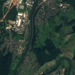
Satellite: Sentinel-2 cloudless 2016 by EOX IT Services GmbH · CC BY 4.0 · Contains modified Copernicus Sentinel data 2016
7.8 km SW

Saar, Rheinland-Pfalz

River
Saar, Rheinland-Pfalz

Mountains

Erbeskopf
Photo: Jörg Braukmann · CC BY-SA 4.0 · Wikimedia CommonsReport this photo · linked, not stored
32 km E

Erbeskopf

816 m · Hunsrück
Erbeskopf
Kahlheid
Photo: Mabol! · CC BY-SA 3.0 · Wikimedia CommonsReport this photo · linked, not stored
34 km E

Kahlheid

766 m · Idar Forest
Kahlheid
Ruppelstein
Photo: Unimog404 · CC BY-SA 3.0 · Wikimedia CommonsReport this photo · linked, not stored
31 km E

Ruppelstein

763 m · Black Forest High Forest
Ruppelstein

Heritage

Cathedral of Trier
Photo: Berthold Werner · CC BY-SA 3.0 · Wikimedia CommonsReport this photo · linked, not stored
0.3 km E

Cathedral of Trier

part of UNESCO World Heritage Site · 1235
Cathedral of Trier
Liebfrauenkirche, Trier
Photo: Berthold Werner · Public domain · Wikimedia CommonsReport this photo · linked, not stored
0.3 km E

Liebfrauenkirche, Trier

part of UNESCO World Heritage Site · 1260
Liebfrauenkirche, Trier
Porta Nigra
Photo: Thomas Wolf, www.foto-tw.de · CC BY-SA 3.0 de · Wikimedia CommonsReport this photo · linked, not stored
0.6 km NE

Porta Nigra

cultural heritage monument in Rhineland-Palatinate · 180
Porta Nigra

Museums

Treasury of the Cathedral of Trier
Photo: Kleon3 · CC BY-SA 4.0 · Wikimedia CommonsReport this photo · linked, not stored
0.3 km E

Treasury of the Cathedral of Trier

1200
Treasury of the Cathedral of Trier
Rheinisches Landesmuseum Trier
Photo: Berthold Werner · Public domain · Wikimedia CommonsReport this photo · linked, not stored
0.6 km SE

Rheinisches Landesmuseum Trier

1877
Rheinisches Landesmuseum Trier
City Museum Simeonstift, Trier
Photo: Berthold Werner · CC BY-SA 3.0 · Wikimedia CommonsReport this photo · linked, not stored
0.5 km NE

City Museum Simeonstift, Trier

Art museum
City Museum Simeonstift, Trier