Skip to content
Destinations
Weather & climate
Nature
Outdoors
Culture
Events
Sky & live
Points Cave
Photo: Thilo Parg · CC BY-SA 4.0 · Wikimedia Commons
Points CaveReport this photo · linked, not stored
Vestiges
Photo: Celeda · CC BY-SA 4.0 · Wikimedia Commons
VestigesReport this photo · linked, not stored
Vestiges
Dolmens du Chanet
Photo: Celeda · CC BY-SA 4.0 · Wikimedia Commons
Dolmens du ChanetReport this photo · linked, not stored
Dolmens du Chanet
Pié de Mounié
Photo: Manuel Peyrolais · CC BY-SA 4.0 · Wikimedia Commons
Pié de MouniéReport this photo · linked, not stored
Pié de Mounié
Baume d'Oullins
Photo: Pmau · CC BY-SA 4.0 · Wikimedia Commons
Baume d'OullinsReport this photo · linked, not stored
Baume d'Oullins
cave with prehistoric artLe Garn, Occitanie

Points Cave

monument historique inscritclassified historical monument
Typecave with prehistoric art
Built–
Best monthsApr–May · Sepweather in Le Garn
44.34° N, 4.49° EUTC+1 · Central European Standard Time
When to goLe Garn · weather score
JanFebMarAprMayJunJulAugSepOctNovDec74October
Best timeApr–May · Sep
October: high / low19° / 9°
iAbout

Points Cave in brief

Points Cave is a cave with prehistoric art in Le Garn, Occitanie, France.

It holds the designations monument historique inscrit and classified historical monument.

For a visit, the weather in Le Garn is best in April, May and September; in October afternoons average 19°.

Le Garn: weather and travel guide

Facts

Type
cave with prehistoric art
Designation
monument historique inscrit
classified historical monument
Nearest town
Le Garn
Region
Occitanie
Coordinates
44.33776, 4.49350
iiLocation

Where to find it

iiiWhen to visit

Weather in Le Garn

Climate guide

Month score for sightseeing

Best Apr–May · Sep
34
Jan
46
Feb
65
Mar
76
Apr
74
May
72
Jun
62
Jul
62
Aug
83
Sep
74
Oct
48
Nov
33
Dec
ivNearby

More heritage close by

All monuments in France
Vestiges
Photo: Celeda · CC BY-SA 4.0 · Wikimedia CommonsReport this photo · linked, not stored

Vestiges

1.0 km NE
monument historique inscrit
Vestiges
Dolmens du Chanet
Photo: Celeda · CC BY-SA 4.0 · Wikimedia CommonsReport this photo · linked, not stored

Dolmens du Chanet

1.5 km NW
classified historical monument
Dolmens du Chanet
Pié de Mounié
Photo: Manuel Peyrolais · CC BY-SA 4.0 · Wikimedia CommonsReport this photo · linked, not stored

Pié de Mounié

2.0 km S
classified historical monument
Pié de Mounié
Baume d'Oullins
Photo: Pmau · CC BY-SA 4.0 · Wikimedia CommonsReport this photo · linked, not stored

Baume d'Oullins

2.9 km W
classified historical monument
Baume d'Oullins
Cave Saint-Marcel-d'Ardèche
Photo: Getfunky Paris · CC BY 2.0 · Wikimedia CommonsReport this photo · linked, not stored

Cave Saint-Marcel-d'Ardèche

3.8 km E
classified historical monument
Cave Saint-Marcel-d'Ardèche
Chabot Cave
Photo: Thilo Parg · CC BY-SA 4.0 · Wikimedia CommonsReport this photo · linked, not stored

Chabot Cave

4.4 km SE
classified historical monument
Chabot Cave
Around here

Le Garn and around

Le Garn
Photo: C Pierre. · CC BY-SA 3.0 · Wikimedia CommonsReport this photo · linked, not stored

Le Garn

Occitanie · France
Apr–May · Sepbest months
30°July high
266 maltitude
Le Garn

Nature

Chauvet Cave
Photo: Inocybe at French Wikipedia · Public domain · Wikimedia CommonsReport this photo · linked, not stored
10 km NW

Chauvet Cave

Cave
Chauvet Cave
Aven d'Orgnac
Photo: Benh LIEU SONG · CC BY-SA 3.0 · Wikimedia CommonsReport this photo · linked, not stored
5.1 km W

Aven d'Orgnac

Cave
Aven d'Orgnac
Grotte Chauvet 2 - Ardèche
Photo: Claude Valette · CC BY-SA 4.0 · Wikimedia CommonsReport this photo · linked, not stored
12 km N

Grotte Chauvet 2 - Ardèche

Cave
Grotte Chauvet 2 - Ardèche

Mountains

Cham du Cros
Photo: Alainauzas · CC BY-SA 3.0 · Wikimedia CommonsReport this photo · linked, not stored
38 km NW

Cham du Cros

1,202 m · Tanargue
Cham du Cros
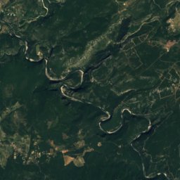
Satellite: Sentinel-2 cloudless 2016 by EOX IT Services GmbH · CC BY 4.0 · Contains modified Copernicus Sentinel data 2016
14 km N

Dent de Rez

726 m
Dent de Rez
Mont Bouquet
Photo: Lau- · CC BY-SA 3.0 · Wikimedia CommonsReport this photo · linked, not stored
24 km SW

Mont Bouquet

629 m · Massif Central
Mont Bouquet

Heritage

Pié de Mounié
Photo: Manuel Peyrolais · CC BY-SA 4.0 · Wikimedia CommonsReport this photo · linked, not stored
2.5 km NE

Pié de Mounié

classified historical monument
Pié de Mounié
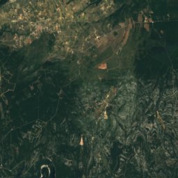
Satellite: Sentinel-2 cloudless 2016 by EOX IT Services GmbH · CC BY 4.0 · Contains modified Copernicus Sentinel data 2016
10 km NW

Chauvet Cave

classified historical monument
Chauvet Cave
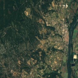
Satellite: Sentinel-2 cloudless 2016 by EOX IT Services GmbH · CC BY 4.0 · Contains modified Copernicus Sentinel data 2016
5.1 km W

Aven d'Orgnac

Grand site de France
Aven d'Orgnac

Museums

Satellite: Sentinel-2 cloudless 2016 by EOX IT Services GmbH · CC BY 4.0 · Contains modified Copernicus Sentinel data 2016
4.0 km W

Cité de la Préhistoire

Cité de la Préhistoire