Skip to content
Destinations
Weather & climate
Nature
Outdoors
Culture
Events
Sky & live
Fyrkat
Photo: Ajepbah · CC BY-SA 3.0 · Wikimedia Commons
FyrkatReport this photo · linked, not stored
Hobro Station
Photo: Beethoven9 · CC BY-SA 3.0 · Wikimedia Commons
Hobro StationReport this photo · linked, not stored
Hobro Station
circular rampartHobro, North Denmark

Fyrkat

protected ancient monument in Denmarkpart of UNESCO World Heritage Site
Typecircular rampart
Built–
Best monthsJun–Augweather in Hobro
56.62° N, 9.77° EUTC+2 · Central European Summer Time
When to goHobro · weather score
JanFebMarAprMayJunJulAugSepOctNovDec27October
Best timeJun–Aug
October: high / low12° / 7°
iAbout

Fyrkat in brief

Fyrkat is a circular rampart in Hobro, North Denmark, Denmark.

It holds the designations protected ancient monument in Denmark and part of UNESCO World Heritage Site.

For a visit, the weather in Hobro is best in June, July and August; in October afternoons average 12°.

Hobro: weather and travel guide

Facts

Type
circular rampart
Designation
protected ancient monument in Denmark
part of UNESCO World Heritage Site
Nearest town
Hobro
Region
North Denmark
Coordinates
56.62324, 9.77045
iiLocation

Where to find it

iiiWhen to visit

Weather in Hobro

Climate guide

Month score for sightseeing

Best Jun–Aug
ivNearby

More heritage close by

All monuments in Denmark
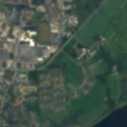
Satellite: Sentinel-2 cloudless 2016 by EOX IT Services GmbH · CC BY 4.0 · Contains modified Copernicus Sentinel data 2016

H.I. Bies Bryggeri

2.2 km NE
monument on Kulturstyrelsen register
H.I. Bies Bryggeri
Hobro Station
Photo: Beethoven9 · CC BY-SA 3.0 · Wikimedia CommonsReport this photo · linked, not stored

Hobro Station

2.4 km N
monument on Kulturstyrelsen register
Hobro Station
Around here

Hobro and around

Hobro
Photo: Frank Vincentz · CC BY-SA 3.0 · Wikimedia CommonsReport this photo · linked, not stored

Hobro

North Denmark · Denmark
Jun–Augbest months
20°July high
12 maltitude
Hobro

Nature

Glenstrup Sø
Photo: Nico-dk · CC BY-SA 3.0 · Wikimedia CommonsReport this photo · linked, not stored
6.4 km SE

Glenstrup Sø

Lake · 13 m
Glenstrup Sø
Klejtrup Sø
Photo: Alicudi · CC BY-SA 4.0 · Wikimedia CommonsReport this photo · linked, not stored
10 km SW

Klejtrup Sø

Lake
Klejtrup Sø
Kielstrup Sø
Photo: Nico-dk · CC BY-SA 3.0 · Wikimedia CommonsReport this photo · linked, not stored
9.5 km E

Kielstrup Sø

Lake
Kielstrup Sø

Heritage

Hobro Station
Photo: Beethoven9 · CC BY-SA 3.0 · Wikimedia CommonsReport this photo · linked, not stored
0.5 km W

Hobro Station

monument on Kulturstyrelsen register · 1869
Hobro Station
Satellite: Sentinel-2 cloudless 2016 by EOX IT Services GmbH · CC BY 4.0 · Contains modified Copernicus Sentinel data 2016
0.5 km S

H.I. Bies Bryggeri

monument on Kulturstyrelsen register
H.I. Bies Bryggeri
Hjerritsdal Watermill
Photo: Akoopal (talk) · CC BY-SA 3.0 · Wikimedia CommonsReport this photo · linked, not stored
3.6 km NE

Hjerritsdal Watermill

monument on Kulturstyrelsen register · 1830
Hjerritsdal Watermill

Museums

Hobro Museum
Photo: Frank Vincentz · CC BY-SA 3.0 · Wikimedia CommonsReport this photo · linked, not stored
0.7 km S

Hobro Museum

Cultural history museum
Hobro Museum
Gasmuseum Hobro
Photo: Frank Vincentz · CC BY-SA 3.0 · Wikimedia CommonsReport this photo · linked, not stored
1.1 km SE

Gasmuseum Hobro

Gasmuseum Hobro
Vikingemuseet Fyrkat
Photo: Ajepbah · CC BY-SA 3.0 · Wikimedia CommonsReport this photo · linked, not stored
2.1 km S

Vikingemuseet Fyrkat

Open-air museum
Vikingemuseet Fyrkat