
Photo: Deinocheirus · CC BY-SA 3.0 · Wikimedia Commons
MaplelawnReport this photo · linked, not stored
MaplelawnReport this photo · linked, not stored

Photo: The original uploader was Demetri1968 at English Wikipedia. · CC BY-SA 3.0 · Wikimedia Commons
Main BuildingReport this photo · linked, not stored
Main BuildingMain BuildingReport this photo · linked, not stored

Photo: P199 · CC BY-SA 3.0 · Wikimedia Commons
K.W. Neatby BuildingReport this photo · linked, not stored
K.W. Neatby BuildingK.W. Neatby BuildingReport this photo · linked, not stored

Photo: Lezumbalaberenjena at English Wikipedia · Public domain · Wikimedia Commons
Dominion ObservatoryReport this photo · linked, not stored
Dominion ObservatoryDominion ObservatoryReport this photo · linked, not stored

Photo: P199 · CC BY 2.5 · Wikimedia Commons
Central Experimental FarmReport this photo · linked, not stored
Central Experimental FarmCentral Experimental FarmReport this photo · linked, not stored
houseTunney's Pasture, Ontario
Maplelawn
national historic site of Canadaclassified federal heritage building of CanadaBuilt 1834
Typehouse
Built1834
Best monthsMay–Jun · Sepweather in Tunney's Pasture
45.39° N, 75.76° WUTC−4 · Eastern Daylight Time
Standing for192 years
built 1834today 2026
When to goTunney's Pasture · weather score
Best timeMay–Jun · Sep
October: high / low13° / 4°
iAbout
Maplelawn in brief
Maplelawn is a house in Tunney's Pasture, Ontario, Canada.
It holds the designations national historic site of Canada, classified federal heritage building of Canada and designated heritage property (part IV).
The house dates from 1834.
For a visit, the weather in Tunney's Pasture is best in May, June and September; in October afternoons average 13°.
Facts
- Type
- house
- Designation
- national historic site of Canada
- classified federal heritage building of Canada
- designated heritage property (part IV)
- Built
- 1834
- Nearest town
- Tunney's Pasture
- Region
- Ontario
- Coordinates
- 45.38820, -75.76200
iiLocation
Where to find it
iiiWhen to visit
Climate guideWeather in Tunney's Pasture
Month score for sightseeing
Best May–Jun · Sep25
Jan
25
Feb
24
Mar
30
Apr
71
May
65
Jun
59
Jul
64
Aug
77
Sep
43
Oct
19
Nov
15
Dec
ivNearby
All monuments in CanadaMore heritage close by
Photo: The original uploader was Demetri1968 at English Wikipedia. · CC BY-SA 3.0 · Wikimedia CommonsReport this photo · linked, not stored
Main Building
2.9 km NE
recognized federal heritage building of Canada
Photo: Lezumbalaberenjena at English Wikipedia · Public domain · Wikimedia CommonsReport this photo · linked, not stored
Dominion Observatory
3.8 km E
classified federal heritage building of Canada

Photo: SimonP at the English-language Wikipedia · CC BY-SA 3.0 · Wikimedia CommonsReport this photo · linked, not stored
Riverview
3.9 km N
classified heritage immovable

Devonshire Community Public School
3.9 km NE
designated heritage property (part IV)
Around here
Tunney's Pasture and around

Nature


Heritage

Sir John Carling Building
recognized federal heritage building of Canada · 1967

Christ Church Cathedral, Ottawa
designated heritage property (part IV) · 1873
Photo: SimonP at the English-language Wikipedia · CC BY-SA 3.0 · Wikimedia CommonsReport this photo · linked, not stored
Riverview
classified heritage immovable · 1865
Museums


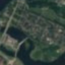


Satellite: Sentinel-2 cloudless 2016 by EOX IT Services GmbH · CC BY 4.0 · Contains modified Copernicus Sentinel data 2016
Canadian Children's Museum
Children's museum · 1986