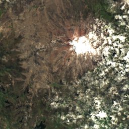
Satellite: Sentinel-2 cloudless 2016 by EOX IT Services GmbH · CC BY 4.0 · Contains modified Copernicus Sentinel data 2016
Outdoor activitiesPatate
Outdoors near Patate
within 15 km44places
Viewpoints27
Camp sites9
1.31° S, 78.51° WElevation 2,176 mUTC−5 · Ecuador Time
When to goPatate · weather score
Best timeJan · Aug · Dec
October: high / low19° / 11°
Viewpoints
| Name | Nearby | Details |
|---|---|---|
| Vista del volcán Tungurahua | 11.2 km | 2,577 m |
| Mirador Ojos del volcán Tungurahua | 11.3 km | 2,577 m |
| Monumento a la Virgen | 13.3 km | 2,061 m |
| Vulcano Tungurahua | 12.9 km | |
| View point Las Antenas | 10.8 km | |
| Juive Chico | 12.1 km | |
| Río Pastaza | 12.4 km | |
| Pastaza overview | 13.1 km | |
| Viewpoint of Banos | 13.6 km | |
| Pondoa : Comunidad ecoturística | 13.8 km | |
| Cascada de Mundug | 4.9 km | |
| Cascada Manteles | 5.5 km |
Viewpoints in Tungurahua Province
Camp sites
| Name | Nearby | Details |
|---|---|---|
| Great place for tent | 12.9 km | |
| Place for tent | 14 km | |
| Camping | 13.1 km | |
| Patio de maquinarias del GAD municipal | 4.6 km | |
| Centro Turistico Quillan | 10.8 km | |
| Ojos del Volcán Camping | 11.2 km | |
| Camping Lo De Fausto Alojamiento | 12.7 km | |
| Eco Camping Lo de Fausto | 12.8 km | |
| Illuchi Camping | 12.9 km |
Camp sites in Tungurahua Province
Hot springs & thermal baths
| Name | Nearby | Details |
|---|---|---|
| Piscinas Termas De La Virgenthermal baths | 13.8 km | |
| El Salado Hot Springsnatural spring | 13.3 km | |
| Termas Antiguas de la Virgenthermal baths | 13.9 km | |
| Termas de La Virgenthermal baths | 13.8 km | |
| Termas de Santa Ananatural spring | 14.5 km |
Hot springs & thermal baths in Tungurahua Province
Mountain huts
| Name | Nearby | Details |
|---|---|---|
| Quinta Recepciones El Belenstaffed | 6.6 km | Website |
| Fregadorunstaffed shelter | 13.3 km |
Zoos
| Name | Nearby | Details |
|---|---|---|
| Ecozoológico San Martín | 12.3 km | Website |
Places come from an open map made by volunteers: well-known sites are there, small or new ones may be missing. Opening times and prices change, so check before you go.