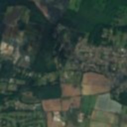
衛星: Sentinel-2 cloudless 2016(EOX IT Services GmbH) · CC BY 4.0 · 改変したCopernicus Sentinelデータ(2016年)を含みます

写真: Mertbiol · CC0 · Wikimedia Commons
'The Cross': a hill-figure war memorial at Lenhamこの写真を報告 · リンクのみ、保存なし
'The Cross': a hill-figure war memorial at Lenham'The Cross': a hill-figure war memorial at Lenhamこの写真を報告 · リンクのみ、保存なし
遺産レナム, イングランド
Tithe Barn、レナム
種類史跡
年代–
ベストシーズン6月–7月 · 9月レナムの天気
北緯51.24°、東経0.72°UTC+0 · グリニッジ標準時
旅行時期レナム · 天気スコア
ベストシーズン6月–7月 · 9月
10月:最高 / 最低15° / 8°
iこのサイトについて
Tithe Barn、レナムの概要
Tithe Barn、レナム(史跡)はレナム、イングランド、イギリスにあります。
訪れるなら、レナム周辺の天気が最も快適なのは6月、7月、9月です。10月の午後の平均最高気温は約15°です。
ii所在地
場所
iii訪問時期
気候ガイドレナムの天気
観光の月間スコア
ベスト 6月–7月 · 9月16
1月
22
2月
31
3月
54
4月
68
5月
72
6月
71
7月
70
8月
73
9月
46
10月
21
11月
15
12月
iv周辺
イギリスの史跡一覧周辺のほかの史跡
衛星: Sentinel-2 cloudless 2016(EOX IT Services GmbH) · CC BY 4.0 · 改変したCopernicus Sentinelデータ(2016年)を含みます
St Mary's Church、レナム
100 m未満 北東
'The Cross': a hill-figure war memorial at Lenham
1.0 km 北東
衛星: Sentinel-2 cloudless 2016(EOX IT Services GmbH) · CC BY 4.0 · 改変したCopernicus Sentinelデータ(2016年)を含みます
Chilston Park
2.0 km 南
衛星: Sentinel-2 cloudless 2016(EOX IT Services GmbH) · CC BY 4.0 · 改変したCopernicus Sentinelデータ(2016年)を含みます
St John the Baptist's Church、ハリエットシャム
2.6 km 北西
衛星: Sentinel-2 cloudless 2016(EOX IT Services GmbH) · CC BY 4.0 · 改変したCopernicus Sentinelデータ(2016年)を含みます
Bell Farm House、ハリエットシャム
2.8 km 西
衛星: Sentinel-2 cloudless 2016(EOX IT Services GmbH) · CC BY 4.0 · 改変したCopernicus Sentinelデータ(2016年)を含みます
Boughton Place
3.0 km 南西
周辺
レナムとその周辺

自然


遺産
'The Cross': a hill-figure war memorial at Lenham
1922
衛星: Sentinel-2 cloudless 2016(EOX IT Services GmbH) · CC BY 4.0 · 改変したCopernicus Sentinelデータ(2016年)を含みます
St Mary's Church、レナム
1101
衛星: Sentinel-2 cloudless 2016(EOX IT Services GmbH) · CC BY 4.0 · 改変したCopernicus Sentinelデータ(2016年)を含みます
St John the Baptist's Church、ハリエットシャム
1101


