







本文へスキップ
旅先
天気と気候
自然
アウトドア
文化
イベント
空とライブ
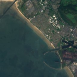
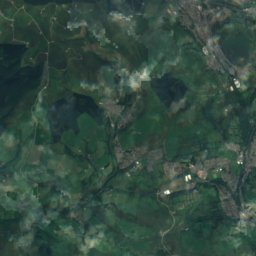
衛星: Sentinel-2 cloudless 2016(EOX IT Services GmbH) · CC BY 4.0 · 改変したCopernicus Sentinelデータ(2016年)を含みます
Norwegian Church
写真: Michael Gwyther-Jones from UK · CC BY 2.0 · Wikimedia Commons
Norwegian Churchこの写真を報告 · リンクのみ、保存なし
Norwegian Church
ピアヘッド・ビルディング
写真: Tony Hisgett from Birmingham, UK · CC BY 2.0 · Wikimedia Commons
ピアヘッド・ビルディングこの写真を報告 · リンクのみ、保存なし
ピアヘッド・ビルディング
Penarth Pier
写真: Ben Salter · CC BY 2.0 · Wikimedia Commons
Penarth Pierこの写真を報告 · リンクのみ、保存なし
Penarth Pier
The Point
写真: Seth Whales · CC BY-SA 3.0 · Wikimedia Commons
The Pointこの写真を報告 · リンクのみ、保存なし
The Point
川ペンアルス, ウェールズ

River Ely

種類川
年代–
ベストシーズン6月–7月 · 9月ペンアルスの天気
北緯51.45°、西経3.17°UTC+0 · グリニッジ標準時
旅行時期ペンアルス · 天気スコア
1月2月3月4月5月6月7月8月9月10月11月12月4510月
ベストシーズン6月–7月 · 9月
10月:最高 / 最低15° / 8°
iこのサイトについて

River Elyの概要

River Ely(川)はペンアルス、ウェールズ、イギリスにあります。

訪れるなら、ペンアルス周辺の天気が最も快適なのは6月、7月、9月です。10月の午後の平均最高気温は約15°です。

ペンアルス:天気と気候ガイド

基本情報

種類
川
最寄りの町
ペンアルス
地域
ウェールズ
座標
北緯51.45000°、西経3.16667°
ii所在地

場所

iii訪問時期

ペンアルスの天気

気候ガイド

観光の月間スコア

ベスト 6月–7月 · 9月
16
1月
20
2月
24
3月
47
4月
59
5月
64
6月
64
7月
63
8月
66
9月
45
10月
25
11月
16
12月
iv周辺

周辺のほかの史跡

イギリスの史跡一覧
衛星: Sentinel-2 cloudless 2016(EOX IT Services GmbH) · CC BY 4.0 · 改変したCopernicus Sentinelデータ(2016年)を含みます

St Augustine's Church、ペンアルス

1.0 km 南
St Augustine's Church、ペンアルス
Norwegian Church
写真: Michael Gwyther-Jones from UK · CC BY 2.0 · Wikimedia Commonsこの写真を報告 · リンクのみ、保存なし

Norwegian Church

1.3 km 北
Norwegian Church
ピアヘッド・ビルディング
写真: Tony Hisgett from Birmingham, UK · CC BY 2.0 · Wikimedia Commonsこの写真を報告 · リンクのみ、保存なし

ピアヘッド・ビルディング

1.5 km 北
ピアヘッド・ビルディング
Penarth Pier
写真: Ben Salter · CC BY 2.0 · Wikimedia Commonsこの写真を報告 · リンクのみ、保存なし

Penarth Pier

1.7 km 南
Penarth Pier
The Point
写真: Seth Whales · CC BY-SA 3.0 · Wikimedia Commonsこの写真を報告 · リンクのみ、保存なし

The Point

1.7 km 北
The Point
衛星: Sentinel-2 cloudless 2016(EOX IT Services GmbH) · CC BY 4.0 · 改変したCopernicus Sentinelデータ(2016年)を含みます

ペンアルス

1.7 km 南
ペンアルス
周辺

ペンアルスとその周辺

ペンアルス
写真: Geof Sheppard · CC BY-SA 4.0 · Wikimedia Commonsこの写真を報告 · リンクのみ、保存なし

ペンアルス

ウェールズ · イギリス
6月–7月 · 9月ベストシーズン
21°7月の最高気温
51 m標高
ペンアルス

自然

Cadoxton River
写真: Sakawak4 · CC BY-SA 3.0 · Wikimedia Commonsこの写真を報告 · リンクのみ、保存なし
7.1 km 南西

Cadoxton River

川 · 5 m
Cadoxton River
Goldsland
写真: John Lord · CC BY-SA 2.0 · Wikimedia Commonsこの写真を報告 · リンクのみ、保存なし
7.2 km 西

Goldsland

洞窟
Goldsland
Llanishen Reservoir
写真: Matt Lewis · CC BY-SA 3.0 · Wikimedia Commonsこの写真を報告 · リンクのみ、保存なし
10 km 北

Llanishen Reservoir

湖
Llanishen Reservoir

山

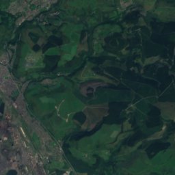
衛星: Sentinel-2 cloudless 2016(EOX IT Services GmbH) · CC BY 4.0 · 改変したCopernicus Sentinelデータ(2016年)を含みます
36 km 北

Coity Mountain

578 m · ブレコン・ビーコンズ山地
Coity Mountain
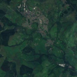
衛星: Sentinel-2 cloudless 2016(EOX IT Services GmbH) · CC BY 4.0 · 改変したCopernicus Sentinelデータ(2016年)を含みます
38 km 北

Cefn Coch, Blaina

571 m
Cefn Coch, Blaina
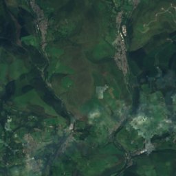
衛星: Sentinel-2 cloudless 2016(EOX IT Services GmbH) · CC BY 4.0 · 改変したCopernicus Sentinelデータ(2016年)を含みます
36 km 北西

Werfa

568 m
Werfa

遺産

ピアヘッド・ビルディング
写真: Tony Hisgett from Birmingham, UK · CC BY 2.0 · Wikimedia Commonsこの写真を報告 · リンクのみ、保存なし
2.9 km 北

ピアヘッド・ビルディング

1897
ピアヘッド・ビルディング
Norwegian Church
写真: Michael Gwyther-Jones from UK · CC BY 2.0 · Wikimedia Commonsこの写真を報告 · リンクのみ、保存なし
2.6 km 北

Norwegian Church

1868
Norwegian Church
衛星: Sentinel-2 cloudless 2016(EOX IT Services GmbH) · CC BY 4.0 · 改変したCopernicus Sentinelデータ(2016年)を含みます
0.3 km 南

Penarth railway station

Penarth railway station

博物館・美術館
Techniquest
写真: Tiia Monto · CC BY-SA 3.0 · Wikimedia Commonsこの写真を報告 · リンクのみ、保存なし
2.7 km 北

Techniquest

科学館 · 1986
Techniquest
衛星: Sentinel-2 cloudless 2016(EOX IT Services GmbH) · CC BY 4.0 · 改変したCopernicus Sentinelデータ(2016年)を含みます
2.9 km 南

Cosmeston Medieval Village

Cosmeston Medieval Village
衛星: Sentinel-2 cloudless 2016(EOX IT Services GmbH) · CC BY 4.0 · 改変したCopernicus Sentinelデータ(2016年)を含みます
0.3 km 南

Turner House Gallery

1888
Turner House Gallery